
ファイル:Political map of England 1140.PNG
このプレビューのサイズ: 736 × 600 ピクセル。 その他の解像度: 295 × 240 ピクセル | 589 × 480 ピクセル | 943 × 768 ピクセル | 1,257 × 1,024 ピクセル | 1,489 × 1,213 ピクセル。
元のファイル (1,489 × 1,213 ピクセル、ファイルサイズ: 163キロバイト、MIME タイプ: image/png)
ウィキメディア・コモンズのファイルページにある説明を、以下に表示します。
|

|
この地図画像は、ベクターイメージである SVG ファイルとして再作成されるべきです。これにはいくつかの利点があります。詳しくはCommons:Media for cleanupを参照してください。この画像の SVG 形式がすでに利用可能である場合は、アップロードしてください。アップロード後、この画像にあるこのテンプレートを{{Vector version available|新しい画像ファイル名.svg}}テンプレートで置き換えてください。
|
概要
| 解説 |
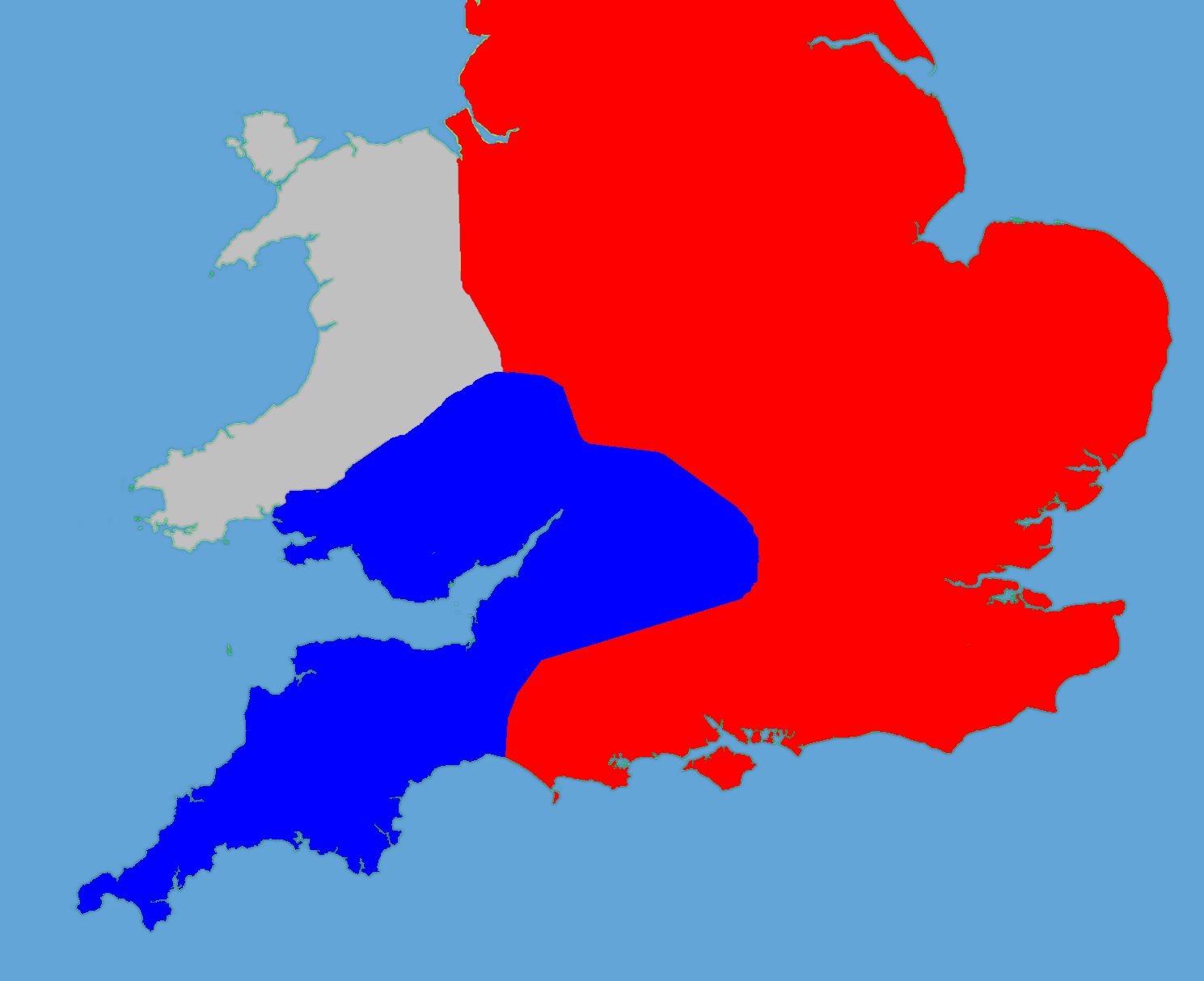
English: A political map of England in 1140 |
| 日付 | (UTC) |
| 原典 |
次のものを使用した投稿者自身による著作物::
|
| 作者 |
|
この画像には画像編集が施されています。原本に対して次のデジタル的な変更が行われました。
|
この作品の著作権者である私は、この作品を以下のライセンスで提供します。
| この著作物の著作権者である私は、この著作物における権利を放棄しパブリックドメインとします。これは全世界で適用されます。 一部の国では、これが法的に可能ではない場合があります。その場合は、次のように宣言します。 私は、あらゆる人に対して、法により必要とされている条件を除き、如何なる条件も課すことなく、あらゆる目的のためにこの著作物を使用する権利を与えます。 |
元のアップロードログ
This image is a derivative work of the following images:
- File:Gb4dot.svg licensed with PD-self
Uploaded with derivativeFX
ファイルの履歴
過去の版のファイルを表示するには、その版の日時をクリックしてください。
| 日付と時刻 | サムネイル | 寸法 | 利用者 | コメント | |
|---|---|---|---|---|---|
| 現在の版 | 2011年5月27日 (金) 18:14 | | 1,489 × 1,213 (163キロバイト) | Hchc2009 | Trimmed to just show the south and Wales |
| 2011年5月27日 (金) 18:11 |  | 1,489 × 1,753 (224キロバイト) | Hchc2009 | {{Information |Description=A political map of England in 1140, based on data in Jim Bradbury's book "Stephen and Matilda", p.89 and p.180. The original map was a blank locator map for Great Britain. The idea is to superimpose Image:dot4gb.svg at the |
ファイルの使用状況
以下のページがこのファイルを使用しています:
グローバルなファイル使用状況
以下に挙げる他のウィキがこの画像を使っています:
- bg.wikipedia.org での使用状況
- en.wikipedia.org での使用状況
- gl.wikipedia.org での使用状況
- hu.wikipedia.org での使用状況
- id.wikipedia.org での使用状況
- it.wikipedia.org での使用状況
- no.wikipedia.org での使用状況
- pt.wikipedia.org での使用状況
- ru.wikipedia.org での使用状況
- tr.wikipedia.org での使用状況